
The trail follows a sandy route that circles around the small butte that is in front of Aztec Butte. There is a spur trail that climbs the back side to a pair of granary sites just under the rim. I climbed the spur trail first before going on to Aztec Butte. The Canyonlands area doesn’t seem to have any large village sites but has a number of small storage sites and rock art sites.
 Further on, Aztec Butte is about a 200 foot climb to the top with the granary sites under the rim on the north side. The butte is one of the highest view points in the immediate area. There are a couple of steep spots climbing up the sandstone face of the Butte that call for a little scrambling. I had a little trouble finding the right spots to put my feet at the point just below the rim but made it up.
 On top there is a circular trail that I followed clockwise. There are several small sites along the somewhat narrow ledge overlooking the very deep Trail Canyon.
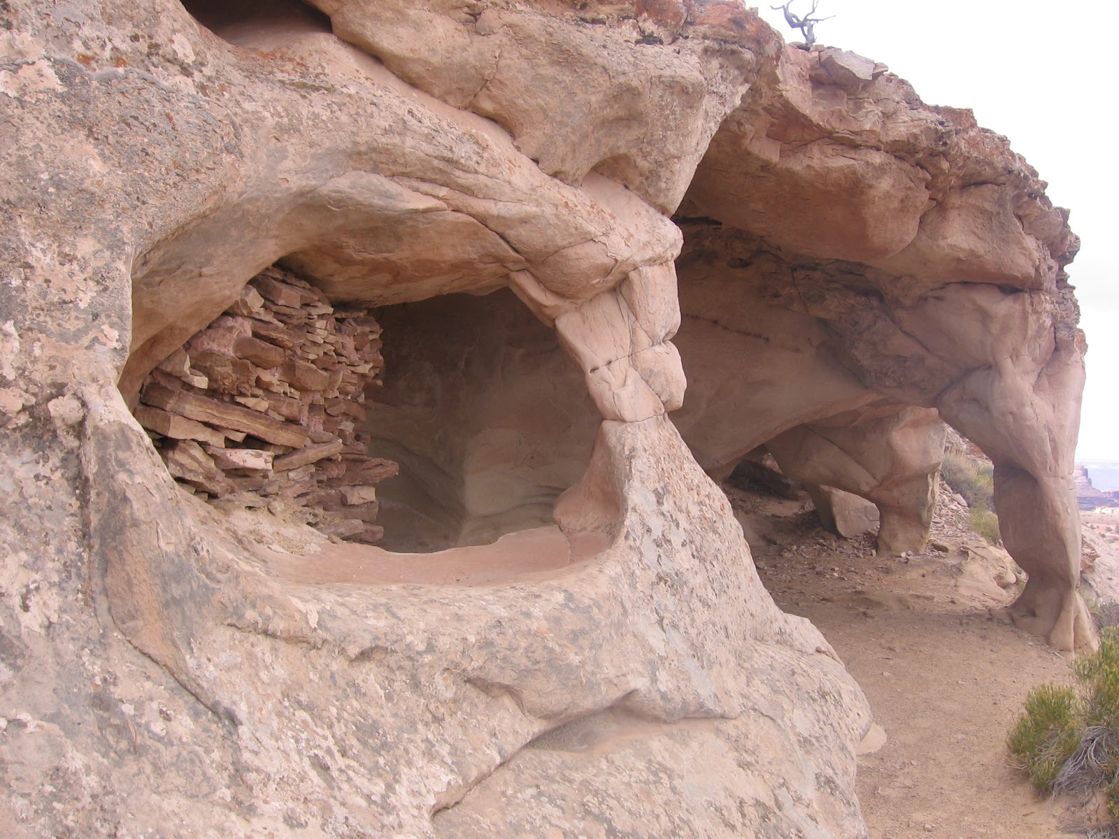

The alcoves seem to feature a number of small arch formations that act as support columns and entryways. There are four or five sections of ancient walls along the length of the ledge.
 There is also a circular structure on the top of the mesa. The Mesa Arch Trail area is visible only a short distance to the east. Also in this area of the park is the Green River Overlook. There isn’t a trail there but there is a glimpse of the Green River and the formations known as Cleopatra’s Chair and the Turk’s Head and others.
 There is also some discussion of John Wesley Powell’s expedition of exploration down the Green and Colorado River. He passed by the area of the overlook on July 16, 1869. My hike at Aztec Butte took about 1:15 hours for the 1.5 miles.
No comments:
Post a Comment