Thursday, April 17, 2008

Dead Horse Point Trails

Dead Horse Point is a Utah State Park across from the Shafer Canyon Overlook in the Island of the Sky District of Canyonlands National Park.
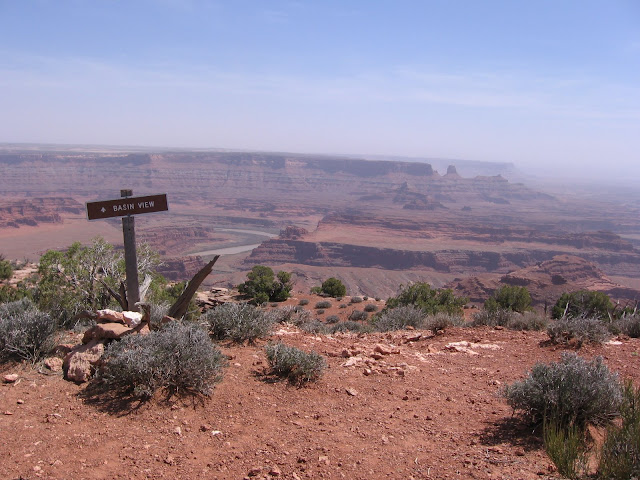
The park has about 10 miles of trails along the rim of the point giving views to the east and west.
I walked a segment from the Visitor Center to Basin View about a 1.5 mile round trip. From here there are views of the Colorado River downstream of Moab and upstream of the confluence with the Green River.

An odd site along this segment is the series of blue lagoons down in the canyon. The Visitor Center interpretive information describes the lagoons as drying beds for potash, a component of fertilizer.
They inject Colorado River water into the deep salt beds, saturating the water with salt, and then the desert sun evaporates the water. Wilderness and industry side by side.
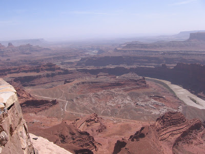

Further south is Dead Horse Point. The same trail allows views to the south, down the canyon and shows the White Rim Road that comes down from Canyonlands.

Slightly to the west is a gooseneck of the Colorado. This can't be seen from the overlooks in Canyonlands. Looking over to the west, you can see the cars at the Shafer Canyon Overlook.

The hike around the point is only 1.0 miles and gives some of the most spectacular views anywhere. Dead Horse Point State Park also has the Intrepid Trails and the Big Cheif Loop that visit the north half of the park.


Wednesday, April 16, 2008

Neck Springs Trail

The Neck Springs Trail in Canyonlands Island in the Sky is a 5.8 mile loop that tours the canyon alcoves just below the "Neck" and visits the seep springs that flow from the sandstone walls. The trail head is just a short distance south of the visitor center at the overlook for Shafer Canyon.

The "Neck" is a 40 foot wide strip that provides the only access to the 43 square mile "Island in the Sky." The trail descends down into the canyon below the road that crosses the Neck.

There are remnants from the old days when ranchers used the springs as a water supply. The trail follows the old rancher trails and those used by wildlife to get to the springs.

There are two main alcoves under the Neck that have some spring water seeping out. The vegetation near the spring is a little more lush than in the desert terrain of the rest of the canyon.

Further on, after several dry alcoves, there is another spring called Cabin Spring. The water flow for all these is just a modest seep.

The trail climbs back out of the canyon and crosses a grassy pasture area, recrosses the road and gives some views both to the west canyon where the hike was and to the east across Shafer Canyon to Dead Horse Point. The Dead Horse Point is part of a Utah State Park and provides spectacular views of the Colorado River.

It took me 3:00 hours to walk the trail. It was about 70 degrees and was a windy spring day.

528614_Cool Camo Russell Outdoors