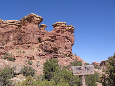
 The Trail Head at Elephant Hill is also the starting point for popular hikes to Chesler Park and Druid Arch. The 4WD trail is rough for vehicles but the walking is reasonably easy, similar to the hiking trails but wider.
 There is a 1.5 mile segment before arriving at the loop portion. I followed the loop clockwise, going the same way that vehicles go. The first part of the hike climbs steeply over rock and then follows a two track sandy road.
 Some of the rocky portions look like some concrete has been used to fill in the bumpiest parts. There are some small signs advising drivers where to back down sections that are too narrow for a normal turn. In the first half of the loop there is a hand print pictograph visible.
 The Devil's Kitchen area is a backpacker campground centered around some rock formations that are particularly black with desert varnish, giving the appearance of having been scorched by sooty fires. There are some short trails into these formations that are shady and cool.
 North and south from the Devils Kitchen is Devils Lane, a narrow grassy corridor with some of the bordering rock formations also blackened by desert varnish. The south section approaches the famous Needles formations. (There is some rock art about 1 mile down the Lane.)

 This trail traverses an area where the Cedar Mesa Sandstone has eroded unevenly, forming shallow depressions. The interpretive material describes how these depressions fill with water following spring or summer rain and support a brief burst of life.
 The unmarked trail head is 2.7 miles past the well known Newspaper Rock site at Mile Post 4, on the east side of Utah Highway 211. The trail is only a few hundred yards long. The panel faces the highway and is at the base of the exposed Wingate Sandstone cliffs that line Indian Creek in this area.
  There is a main panel in the center with more figures to the left and also some to the right. The panel to the right is more eroded than the center panel. This rock art site features some very large figures.
