Wednesday, May 9, 2012

Horseshoe Canyon Trail-High Gallery and Horseshoe Shelter


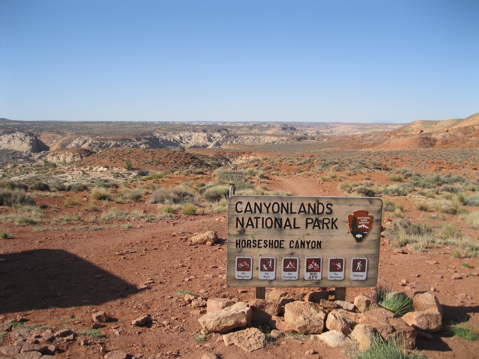
The Horseshoe Canyon Trail is a 6.5 mile round trip with 750 feet of elevation change to four rock art sites including the Great Gallery. It is located in a detached Unit of Canyonlands National Park in southeast Utah.

 I traveled to Horseshoe Canyon by starting in Green River, Utah and following Utah Route 24 for 24 miles to the east leading gravel road turnoff that is across from the turnoff to Goblin Valley State Park.


It is then 32 miles on the gravel road to the trailhead. The road is drivable with 2-wheel drive but has many washboard sections and occasional sandy spots. After 27 miles there is a left turn at the junction with the road that leads south to the Hans Flat Ranger Station. This junction has some area information posted at a kiosk.

After 3.2 more miles there is an easy to miss right turn onto a one lane dirt road that leads the last 1.8 miles. At the trailhead, there is a pit toilet and an information kiosk. The kiosk information shows a map of the trail. It would be good to take notes on where the rock art sites are in relation to each other because they are not all completely obvious. There isn’t a printed trail guide for this spectacular trail.


The first segment of trail follows a rocky old road that was constructed for oil exploration. There are good views down the canyon that was formerly called Barrier Canyon. The creek seems to still be called Barrier Creek though the canyon has changed names.

A single three toed dinosaur track was outlined with small stones in the upper part of the trail. The last segment of the descent has sandy footing. Much of the canyon bottom has sandy footing also. It took me 0:30 minutes to arrive at the canyon bottom and the trail makes a right turn to the south.


The first rock art site, the High Gallery, arrived in 0:15 minutes more of hiking and was obvious on the left or east wall. The trailhead information says that Barrier Canyon rock art was created by Archaic hunter-gatherers in 1000-2000 BC. Most of the figures are colored red by the mineral hematite.


The canyon bottom is lush is spots with Cottonwood trees and other riparian habitat. There wasn't any flowing water during my hike, but there were wet spots and water is probably just below the surface.

The second rock art site, the Horseshoe Shelter, is within view of the High Gallery but is across the creek on the west side, somewhat concealed by the Cottonwood trees. There is a trail segment on the left side of the creek and it is easy to walk past the second rock art site without seeing the side trail on the right side.


There are two panels to find at the Horseshoe Shelter site. The first is obvious once you are in the vicinity.


There aren't any signs along the trail and no further interpretive information posted beyond what is available at the trailhead. The images at Horseshoe Shelter extend up and to the right.


There is a second panel that is somewhat hidden. There is a marked trail to the right of the main panel that circles around and climbs behind some rocks. This second very short trail is easy to overlook.


From the Horseshoe Shelter, the High Gallery across the creek is clearly visible. I was 1:10 hours into my hike when I was ready to move on. (The hike continues on the next post, or use the Horseshoe Canyon Trail label.)


Horseshoe Canyon Trail-Alcove Site to Great Gallery


The Alcove Rock Art Site in Horseshoe Canyon of Canyonlands is about 0:10 minutes of hiking past the Horseshoe Shelter site. The Alcove site is the third of four rock art sites along the trail and is before the famous Great Gallery site.


Standing on the sandy wash surface, the two panels here might be hard to see from the distance. There is a marked entrance to the alcove on the left side.


The panel in the center of the alcove is somewhat obscured by a pile of rocks and seems to include some images that are red on the red color of the stone. The viewing area is on the jumbled pile of stones.


The bottom parts of these images are almost buried by the accumulated debris and the slant of the alcove wall makes viewing them somewhat awkward. 


There is a second panel in the alcove at the right end. This group is high and visible but they are fading.


It is about 0:30 minutes of hiking further to arrive at the Great Gallery. There is a distant view across the creek and a shady place to sit and view closer. Just before arriving there is a relatively lush riparian area segment of trail.


The most eye catching group is outlined in a small alcove on the left. The relative size of the figures seems to give the impression of depth. The tallest figure has been measured at eight feet, but they don’t look that large.


One of the groups of images has a flute player. There are flute players at rock art sites throughout the region from several different cultural groups. Most of the tall images don’t show any arms, but they give the impression of having their arms folded in front of their chests, as if waiting for some response from the viewers.


One of the images to the right side has his eyes pecked into the rock. I only noticed one figure with that feature. There are two ammo boxes in the viewing area with a comment log and a lengthy document with information on rock art. This document is available on line at the Canyonlands Park web site.


During my early May hike, two volunteer rangers were making the hike every day for two weeks, providing some help and interpretation to other hikers. When I arrived at the Great Gallery I was alone there for about 0:30 minutes until they arrived. I visited the Great Gallery for about 0:50 minutes.

My return hike took 2:00 hours and the total hike took 5:00 hours for the 6.5 miles. I carried and drank 4 liters of water on a day that was 52 F degrees at 9:00 AM and 68 F at my 2:00 PM finish.

532497_120 x 90 Starting Salary $42k. Group 1

Monday, May 7, 2012

Murphy Point Overlook Trail


The Murphy Point Overlook Trail is located in the Island of the Sky District of Canyonlands National Park in southeast Utah. The trailhead is on the west side of the main park road, south of the junction with the west leading Upheaval Dome road.


The trailhead sign says it is 1.8 miles to the overlook, or a 3.6 mile round trip. The Murphy Trail branches off to the left after 0.5 miles and leads down to the White Rim Road via two different routes.


The first segment of trail looks like an old road and passes through a pasture like area. There is an old corral along the way. The vegetation changes gradually from the grassland, to a mix Mormon Tea and Blackbrush, and then to rocky Pinon and Juniper desert vegetation.


The best wildflower I saw along the first segment was a cactus. This one happened to have a small lizard climbing on it. There were many of these small lizards along this segment.


About two-thirds of the way to the overlook, there are some views to the west toward the Candlestick Tower. Some of the narrow finger-looking canyons that are visible from the Grand View Point appear here also. As the terrain changes from pasture to rocky desert, the trail becomes a route marked with rock cairns.


There are also some glimpses of the Green River. The formation known as the Turk’s Head is visible in the area where the Green River makes a loop.


At the overlook, there are some of the wide spectacular views for which Canyonlands is famous. I think the formation below to the southwest is called the Murphy Hogback and one of the two branches of the Murphy Trail is visible.


Looking to the southeast, Grand View Point is visible to the left with Junction Butte to the right. My hike for 3.6 miles took 1:30 hours on a 68 F degree early May day. I only saw 5 other hikers on an otherwise busy day weekend day.


528614_Cool Camo Russell Outdoors